

Space debris | ||||
Space debris around the Earth |  Automatic translation Automatic translation | Updated June 01, 2013 | ||
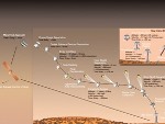
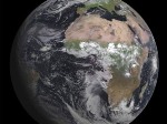
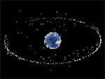
Space debris is by definition an artificial object and residual nonfunctional as opposed to a satellite is operational. Satellites that orbit above our heads are essential because they organize modern life on Earth. They allow communication and data exchanges of all kinds (data, military data, weather data, images, voice...). In orbit above the Earth, there are many more non-functional objects as useful objects. | There are roughly 10 000 to 12 000 objects considered large debris, 12 000 of these objects, there are about 3000 large satellites and 2000 large rocket stages, the 6-7 000 other objects are smaller, straps, hoods and other toolkits... Image: Space debris in orbit that swarm are located everywhere but particularly in two areas fundamental area of low orbit (2000 km altitude) and the area orbit (36,000 km). Debris larger property in order, the United States, Russia, Europe, China and Japan. | 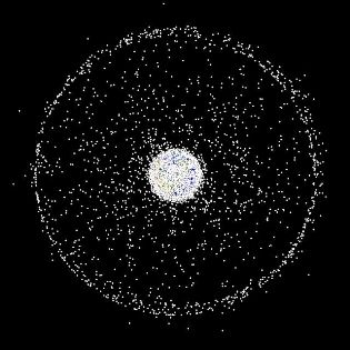 | ||
Orbits garbage cans | ||||
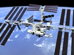
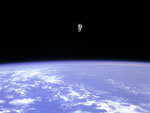
The highest risk is between 800 and 1400 km altitude where the multiplicity of debris is exponential. When debris debris meets another, it creates 114 more debris, which regenerates debris exponentially. | Solutions "butterfly net" or "Mega Magnet"are not taken seriously by the international space community. There is no real solution operational in 2009, to recover the debris, most solutions are still far-fetched. The USSPACECOM maintains several facilities with radar and telescopes, a catalog containing about 15 000 objects larger than 10 cm in LEO and larger than 1 m in GEO. However, the majority of debris is not always observed. According to the Institute of Aerospace Systems, Braunschweig, there are more than 330 million artificial objects with a diameter of at least one millimeter in Earth orbit. Image: The International Space Station must sometimes slalom to avoid a collision. "It will soon be pressing to clean the orbits, "says Christophe Bonnal, head of the file space debris at the Centre National d'Etudes Spatiales. The International Space Station, 415 km altitude is subject of 2 debris alerts per day. | 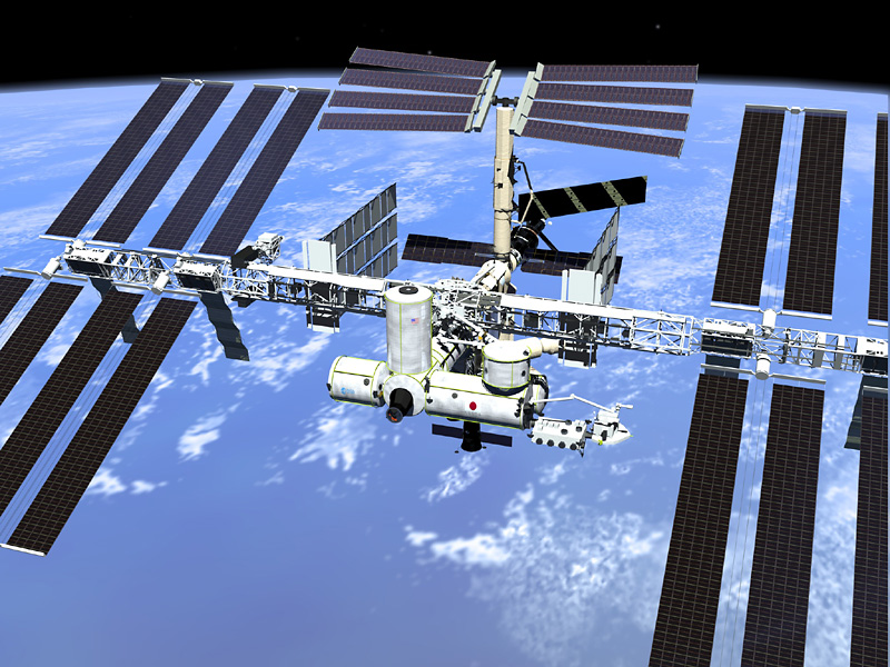 | ||
More debris with Breeze | ||||
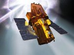
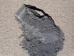
In October 2012, the fourth stage (Breeze M) which put into orbit by the Proton was missed in August 2012, has just broken in the suburbs of the Earth, within a band orbital in which circulate military and scientific satellites and especially the International Space Station. | NB: The Proton is the largest Russian heavy launcher. It is capable of placing a payload of 22 tons into low orbit and more than four tons into geostationary orbit. Developed in the early 1960s, the first successful launch took place in 1965. Since its inception, 362 shots were made. Image: The Breeze-M upper stage with a diameter of 4.15 meters, exploded in space. This is the third time that has happened already in 2007 and 2010 and 16 October 2012. © Khrunichev | 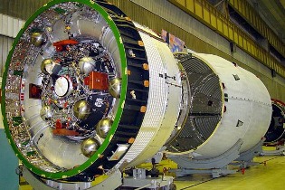 | ||
Space collisions are rare | ||||
On February 10, 2009, a wreck of Russian satellite Cosmos 2251, collided with a U.S. communications satellite operations, Iridium Satellite LLC. The shock has poured a lot of debris in Earth space. Launched September 14, 1997, Iridium 33, fully operational, was on a nearly circular orbit of 783.2 x 786.4 km inclined at 86.4 degrees (thus almost polar). It ceased broadcasting February 10, 2009 at exactly 10 h 56 UT, when it crossed the path of Cosmos 2251. The latter, launched June 16, 1993, of Russian design, no longer worked for ten years and thus included in the list of wrecks in the area. The collision occurred at an altitude of 790 kilometers, where the two objects, relatively similar mass (about one ton) found themselves on the same trajectory. The particularly violent clash occurred at a relative speed of 42 120 km/h resulting in approximately 10 000 additional debris, a number that will increase. | Debris monitoring is too costly to be conducted routinely on all active satellites, that may be why the American satellite does not carry out evasive maneuvers February 10, 2009. Although extremely rare, such collisions have already occurred in the past. | 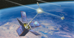 Image: The antenna of the satellite Cerise cut by space debris in 1996. | ||
Highway geostationary | ||||
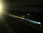
A satellite on a geostationary circular orbit some 36,000 kilometers above the surface of the Earth completes a rotation every 24 hours. | These satellites in the sky leaving marks on images made with frames compensating the Earth's rotation, these trails seem to follow a highway through the heavenly landscape. The following image shows the cons belt of Orion and its famous nebulae. Many trails apparent length of 2.5 ° left by geostationary just scratch the night sky. Image: This wide-field image of the quasi-equatorial region of Orion, showing the heavenly highway. The long exposure images, the night sky taken with telescopes that compensate for the Earth's rotation, can also keep track of geostationary satellites for which the sun still shines at night while on the ground has fallen. |  | ||
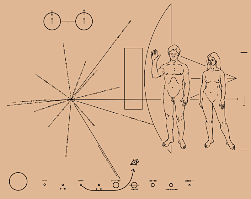 Pioneer, first message to extraterrestrials !
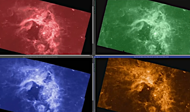 How to see infrared images from JWST?
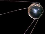 Sputnik, the Russian companion
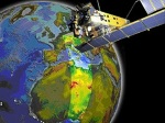 Envisat, the eye high-resolution of the Earth
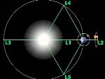 Lagrange points
 Mars Reconnaissance Orbiter
 Kepler space telescope in search of life
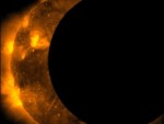 Our satellites also observe eclipses
 Satellite laser ranging - LAGEOS-1
 High-risk landing for Curiosity in 2012
 Cheops, characteristics of exoplanets
 The world of Planck
 Rosetta or rendezvous with a comet
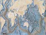 Satellites that measure underwater relief
 Adaptive optics and laser star
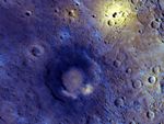 Flyover of Mercury by MESSENGER
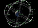 The orbital waltz of GPS satellites
 ISS in low Earth orbit at 415 km altitude
 Voyager 1 leaves us without looking back
 Space telescopes are the eyes of the Earth
 What is a space probe?
 JWST in the depths of space
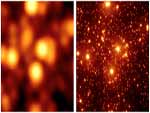
 The GAIA satellite maps the Milky Way
 Free flight in space
 How to calculate the synchronous orbit?
 Modern cathedrals
 Mercury probes
 Space debris are increasing exponentially
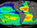 New image of ocean salinity
 The End of the Dark Ages with JWST
 Orbits of celestial objects (Apsis)
 Even finer images for METEOSAT
 Curiosity, the first shovel, sample of Martian soil
 Probes of Mars
 Living on the planet Mars
 Where is the geostationary orbit?
 MOM, the technological demonstration
 Venus probes
 What is an interferometer?
"The data available on this site may be used provided that the source is duly acknowledged."