Volcanoes of the Earth |
Tectonic plates | |  Automatic translation Automatic translation | | Updated June 01, 2013 |
We can not talk about volcanoes without understanding tectonic plates. Tectonic Plates are a theory that revolutionized the vision of geologists. In this theory, the Earth's surface is cut into large plates. The size and position of these plates change in geological time.
The plates move against each other and the edges are places of intense geologic activity, such as earthquakes, volcanic eruptions...
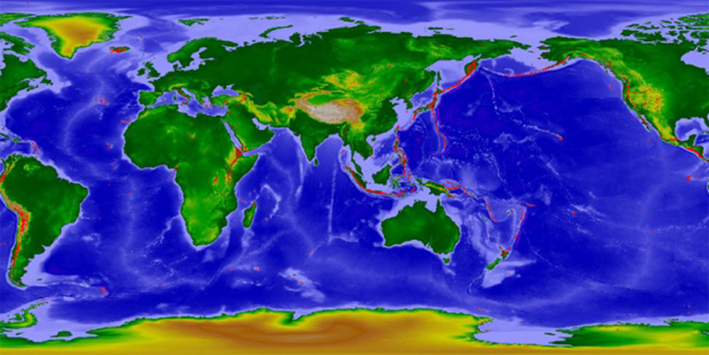
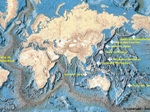
We note that volcanoes are distributed along the tectonic zones of the earth's crust. The most spectacular is the line of volcanoes that draws much of the Pacific Ocean.
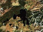
| | This area is called "Ring of Fire". The line of earthquakes and volcanoes coincide line in different places around the world. These areas of intense geologic activity, earthquakes, volcanic eruption or formation of mountains, mark the boundaries between the plates and define lithospheric 7 large plates and 20 smaller ones. Image: The distribution of volcanoes along the tectonic zones. | | 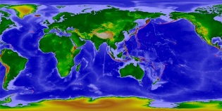 |
Major tectonic plates | | | | |
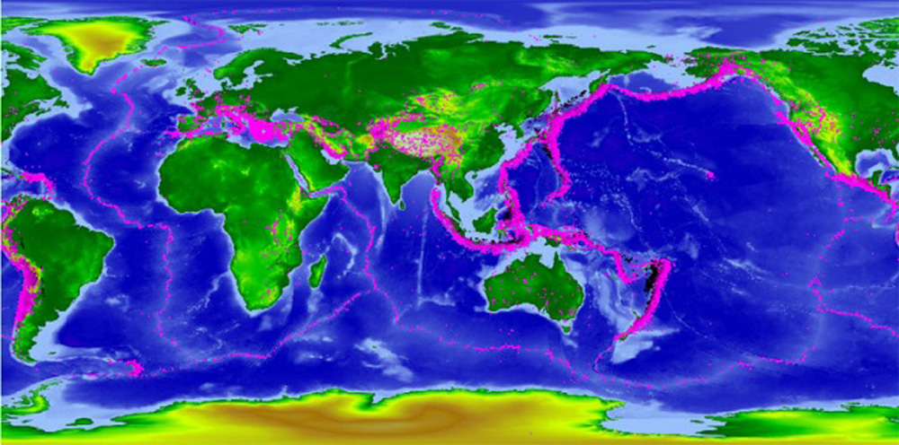
The tectonic plates (initially called continental drift) is the current model of the internal functioning of the Earth. The oceanic plates are located at the Mid Ocean wrinkles. At these places, the oceanic crust is very thin, a few kilometers thick lava happens to clear a permanent move to the surface through large cracks long thousands of kilometers. These cracks, called rift ocean is filled with lava that cools getting closer to the area in contact with water. The lava then crystallize on each wall of the crack, making the new oceanic crust by removing the crust the oldest.
| | This is done to gauge the speed of a few centimeters per year on average and thus Europe and North America were joined there almost 150 million years, were at a distance of another. Image: The main tectonic plates, bounded by the lines of earthquakes. The plate of North America, South America, of Eurasia, Africa, the Pacific, Australia and Antarctica, are visible in this image. | | 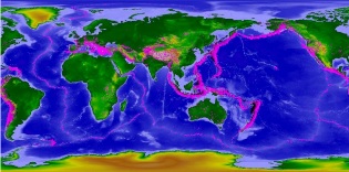 |
Characteristics of a volcano | | | | |
A volcano definition of volcanism, given by an American geologist: "It's all physical and chemical phenomena that accompany the ascent of magma." is composed of three parts: a reservoir of magma in depth, one or more chimneys volcanic communicate with Inside the Earth, and the volcanic mountain which is a Crater, a crater cone, a dome, a lava flow or a deposit product explosion (slicks sanded, etc...)
The Volcanic eruptions give birth to popular beliefs which mixed superstitious terrors and fantastic legends. It is true that some eruptions can be devastating to point to Disappearance of civilizations.
A volcano is a relief of the crust terrestrial (submarine or air) formed by the ejection and stacking Material from the rise of magma in the form of lava and tephra The Téphras represent all materials (solids and liquids, caused by gas) emitted by volcanoes, with the exception of lava; they come from different types of explosive eruptions. such as ash. A volcano is powered by one or more shells Magma.
This magma derived from partial melting of the mantle. It is through chimneys or ducts that molten rock reaches the surface and the accumulation of these rocks can reach thousands of feet thick forming the mountains and even islands.
According the nature of the materials, the type of eruption, their frequency and orogeny The orogeny (from the Greek oros, mountain, and genesis, training) means all the processes leading to the formation of mountain ranges. , volcanoes have various forms, in general they are conical mountains ending in a crater or caldera.
The eruption fate of the volcanic chimney typically located at the top, but there are openings that appear on the flanks of the volcano like Mount Etna.
Volcanoes are classified into two types:
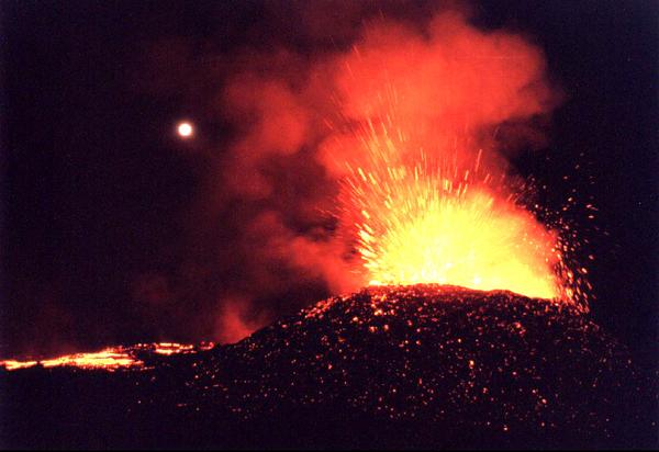
- the "red volcanoes' eruptions effusive relatively quiet, emitting lava fluids in the form of slides, the volcanoes of" hot spot " volcanoes and submarine ocean ridges,
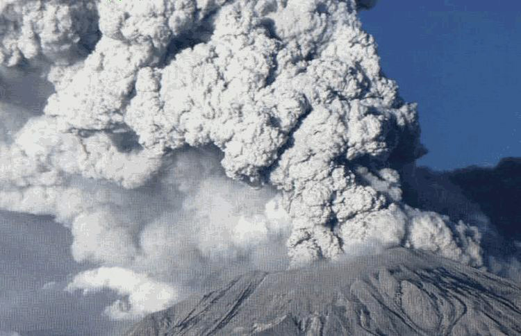
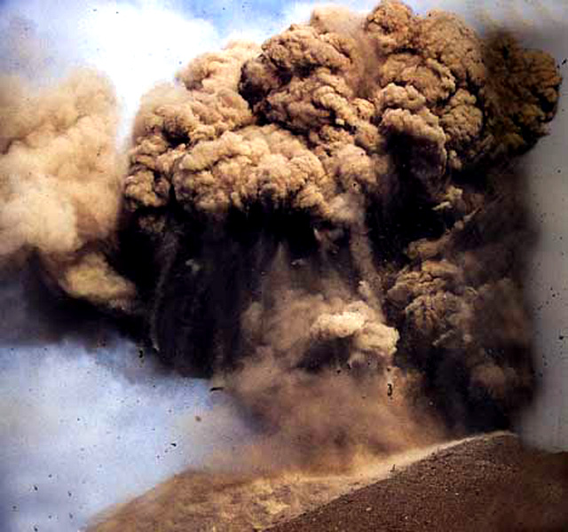
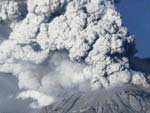
- the" gray volcanoes "to explosive eruptions, emitting pasty lava and ash in the form of fiery clouds (or pyroclastic flows) and volcanic plumes. | | There are about 1 500 active volcanoes land which erupted sixty enter every year.
Volcanoes can cause massive climate disasters, causing a sudden cooling of the mean temperature of Earth. The super volcano eruption in Indonesia in the island of Toba, there are about 73 000 years, spat an impressive amount of ash estimated at about 2 800 km³. By comparison, the eruption of Pinatubo in the early 1990s, has issued only 10 cubic kilometers of ash.
The ashes of Pinatubo have changed the albedo of the Earth and have lowered the mean temperature of 0.6°C for two years. In 1998, a professor of anthropology at the University of Illinois, Stanley Ambrose, said the eruption of Toba caused a global cooling of the planet for 1800 years. The word "volcano" comes from Vulcano, one of the Aeolian islands named in honor of Vulcan, the Roman god of fire. Its equivalent in the Greek pantheon is Hephaestus. For the Romans, Vulcan is one of three son of Jupiter and Juno. Vulcan reigned supreme in the bowels burning volcanoes.
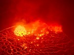
That is why it was taken for the patron saint of blacksmiths as the caption said it had installed its forges into the depths of the crater Vulcano. Image: The red volcanoes, effusive eruptions are relatively quiet, emit fluid lava in the form of castings, the volcanoes of "hot spot". Image: The gray volcanic eruptions explosive issue pasty lava and ash in the form of pyroclastic flows and volcanic plumes | | 
 |
Krakatau - Indonesia | | | | |
Krakatau in Indonesia is a type of explosive volcano which is located in the Sunda Strait between the islands of Sumatra and Java (not to be confused with the island of Krakatau NE Java). Situated 40 km west of Java on Krakatau exploded in August 1883.
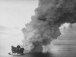
The volcano spraying up dust over 70 km in the atmosphere and the collapse of the crater led to the formation of a caldera triggering a series of tsunamis. The tidal waves swallowed successive towns and coastal villages on the islands of Java and Sumatra, causing 36 400 deaths. The projected volcanic dust in the atmosphere affect the Earth's climate for several years with a fall in mean temperatures of 0.25 ° C. The total energy released is huge and the eruption of Krakatau is often compared to that of Santorin, in antiquity, because of its explosive particularly destructive. Until 20 May 1883, Krakatau was an island that measures 9 km long and 5 km wide, covered with lush tropical vegetation. The human catastrophe begins on August 26 to 13 hours when a violent explosion was heard more than 50 km from the volcano, followed by another to 14 hours, after a series of detonations increasingly violent up to 17 hours. The projections include any ash within a radius of 160 km of Krakatau, plunging the whole region in total darkness. At 10.02, August 27, a cataclysmic explosion is heard in all the Indies and also in Australia.
The sound resonates up thousands of kilometers of Krakatau and was heard for about one twelfth of the earth's surface which would make the phenomenon sound the most important in human history.
The plume of volcanic ash made several times around the globe, and spread enough particles to lower the average global temperature of 0.25 ° C the following year. But the eruption also had beneficial effects on the local environment. Two years later, 26 species of plants appeared to recover these islands of dense forest. The regions as Lampung, infertile before the eruption, became very fertile. The 100 million people living in Java, under the constant threat of thirty volcanoes, taking advantage of this rich land that allows up to three crops of rice annually. | | The volcanoes may have important consequences on the evolution of humankind, and according to David Keys, archeology correspondent for the British newspaper The Independent, the massive eruption of Krakatau which took place in February 535, is the cause of separation between the two islands of Java and Sumatra. The volcanic ash cloud the entire Earth for two years and caused a drop in temperatures for several years, which would have destroyed crops and led to famine. The planet was then delivered to epidemics, especially the bubonic plague, as described in the writings of the monk Evagrius Scholasticus, a contemporary of the Emperor Justinian, which weakened in part the human race, moving all political, religious and social in the world. Keys provides a series of hypothetical patterns from this eruption: the emergence of Islam, the foundation of modern Judaism, creating what is now Pakistan, China's reunification, the collapse of Mayan civilization, the final decline of the Roman Empire. Image: Within the crater is a cone pierced three openings still bubbling. The ashes of the Anak Krakatau, formed in 1941, down its slopes to the sea. | |  Image: Eruption of Krakatau in 1997. |
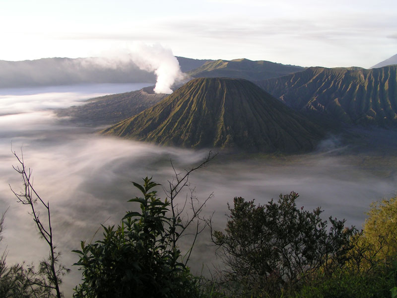
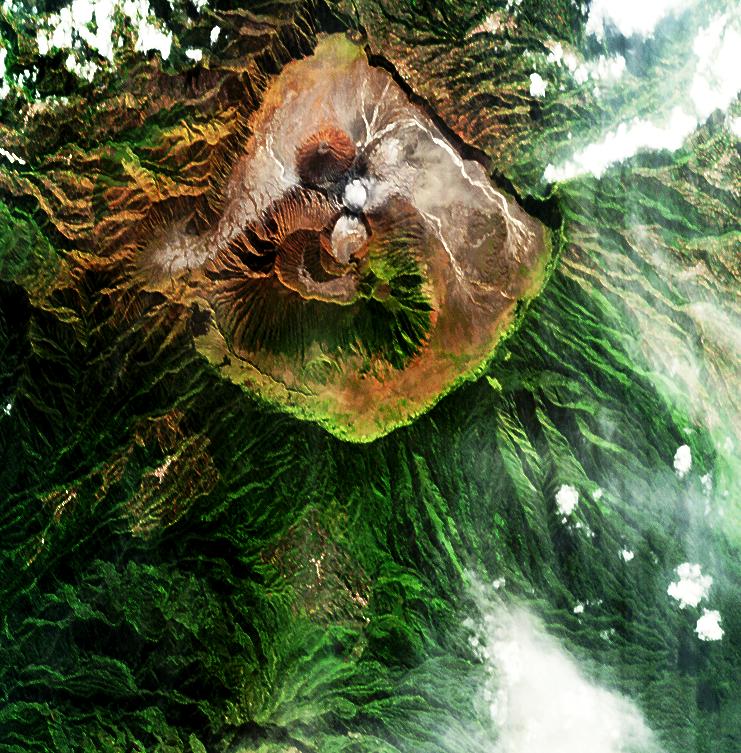
Bromo Volcano - Java - Indonesia | | | | |
There are about 1 500 000 years a huge Stratovolcano, Mount Tengger, probably high of 4,000 m, collapsed from a massive eruption. The gaping hole opened by the disaster in East Java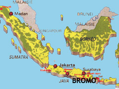 is today one of the most beautiful landscapes of the planet: the Tengger Caldera. The eruptions that can follow the growth of several cones: the Kursi, the Widodaren the Batok and finally, the most famous, the Bromo in activity. This cone of ash incarnation of the god Brahma is revered and feared by the Tengger, Hindu people living near the volcano for centuries. The volcano, very easy to access, is a dangerous tourist attraction in 2004 during an unexpected explosion table there were 3 dead. The Bromo volcano, like all volcanoes, fertilize the fields around and allows for multiple harvests of rice per year through volcanic ash sprinkling regular campaign, coupled with a hot and humid. The Bromo volcano is a sacred place of worship which take place at certain times of the year, large festival in honor of the gods. Thousands of pilgrims in procession then climb to the summit of the volcano to throw their offerings into the crater. Ngadisari is a tiny mountain village, facing one of the largest volcanic landscapes of the world: the vast Tengger caldera. Its crater 20 km in diameter, is filled with volcanic sand-colored brown and ocher. In the center there are several small separate summits. The Batok, an old cone with steep ravines burned. Beside him li.e. the flanks of the true Bromo. A staircase like a Grapple, climbs up to the volcano. Above, a huge crater 300 meters deep for a kilometer wide open on the bowels of the volcano beyond the floor of the caldera on which the volcanic cone. This mouth out a huge plume of steam that can be diluted in the air and hydrogen sulfide unbreathable. The vertical walls are yellowed by sulfur. Volcanic eruptions of the volcano Bromo: is today one of the most beautiful landscapes of the planet: the Tengger Caldera. The eruptions that can follow the growth of several cones: the Kursi, the Widodaren the Batok and finally, the most famous, the Bromo in activity. This cone of ash incarnation of the god Brahma is revered and feared by the Tengger, Hindu people living near the volcano for centuries. The volcano, very easy to access, is a dangerous tourist attraction in 2004 during an unexpected explosion table there were 3 dead. The Bromo volcano, like all volcanoes, fertilize the fields around and allows for multiple harvests of rice per year through volcanic ash sprinkling regular campaign, coupled with a hot and humid. The Bromo volcano is a sacred place of worship which take place at certain times of the year, large festival in honor of the gods. Thousands of pilgrims in procession then climb to the summit of the volcano to throw their offerings into the crater. Ngadisari is a tiny mountain village, facing one of the largest volcanic landscapes of the world: the vast Tengger caldera. Its crater 20 km in diameter, is filled with volcanic sand-colored brown and ocher. In the center there are several small separate summits. The Batok, an old cone with steep ravines burned. Beside him li.e. the flanks of the true Bromo. A staircase like a Grapple, climbs up to the volcano. Above, a huge crater 300 meters deep for a kilometer wide open on the bowels of the volcano beyond the floor of the caldera on which the volcanic cone. This mouth out a huge plume of steam that can be diluted in the air and hydrogen sulfide unbreathable. The vertical walls are yellowed by sulfur. Volcanic eruptions of the volcano Bromo:
08-06-2004, phreatic eruption that created a plume more than 3 km above the crater. The explosion killed 2 people. | |
29-11-2000, a small explosion took place then until the end of January the number of explosions becomes very important, with 99 explosions between 19 and Dec. 25 and eruptive column between 300 and 450 m.
03-03-1995, a small column Ashen rose up to 200 m above the crater. The ash drifted over 20 km to the S and SE destroying crops in their path.
02-06-1980, bombs one meter in diameter were projected at about 400 m from the crater and a plume rose about 800 m above the building.
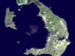
Image: satellite view of the Bromo volcano (top) and the Bromo volcano, photographed during a trip to Asia (bottom).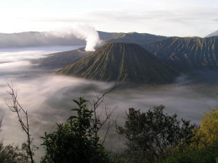 | | 
|
| | | | | |
Etna - Sicily - Italy | | | | |
Etna, also called Mongibello (the Mountain of Mountains), is one of the most active volcanoes in the world.
It is with the Stromboli, near the Hekla and Krafla, Iceland, the volcano of Europe's most active. It dominates its imposing mass of the city of Catania and the entire east coast of Sicily, Italy.
This giant of 45 km in diameter at its base, is slightly elongated in a North-South and culminates currently 3 345 m altitude.
It can also capture its mass since the Greek theater in Taormina where it is the background scene.
If Etna is a regular cone of about 1,200 km2, its slopes are hosting more than 250 volcanic vents.
Etna is marked by a large notch, the Valle del Bove: this valley, 7 km from east to west and 5 km from north to south, which measure the walls in places 1,000 meters high, ripped the eastern flank of the volcano.
From the top escapes a white cloud of water vapor and gases that reflects its activity.
Etna is a recent volcano, the first lava flows visible on the seafront, including the famous rocks of Cyclopes, when approximately 300 000 years.
Etna is located in an area between plate tectonics African and European plate. The summit of Mount Etna has four craters that have opened during the previous century: the crater north-east (1911), the central crater with Voragine (1945) and Bocca Nuova (1968), and the last: Crater South-east (1971).
The summit, the North-east crater, sees its altitude is changed each eruptions But it may, if the cone South-east continues to be overtaken by the latest. If the craters rise in altitude they grow well. Thus, la Bocca Nuova, which was a hole a few meters in diameter in 1968, is now a crater more than 300 m in diameter. | | It is likely that the Bocca Nuova near the Voragine, eventually do more than just a huge central crater. Its four craters lie to 2 900 m and this area is a caldera filled by the succession of successive eruptions.
Chronicles its eruptions are over 2000 years.
The eruptions of Mount Etna is another one behind the other every two years like 2007. Image: explosive aspect (top) and effusive (bottom) of the Etna. | | 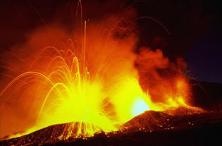
 |
Stromboli - Italy | | | | |
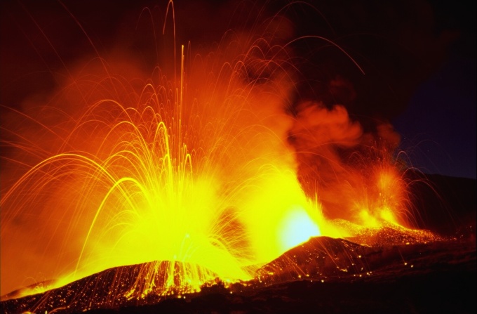
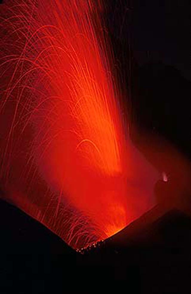
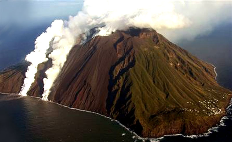
The Stromboli volcano is located in the Aeolian Islands or Lipari Islands, north-west of Sicily, Italy. The Aeolian Islands are the Kingdom of the winds and volcanoes.
The Stromboli spits for millennia its internal fire and lava down its slopes.
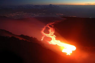
In the past, outbreaks of this flagship of the Mediterranean, intelligence browsers Greek and Etruscan on the near Sicily. The persistent activity of Stromboli addition to those of neighboring volcanoes, Vulcano, Salina, Panarea, and Alicudi Filicudi, the Aeolian Islands. This Stratovolcano, which culminates at 923 m altitude, took sitting on the seabed about 3000 m depth on a continental crust 18 km thick. As Etna, the iceberg of Stromboli is formed by the superimposition of lava and pyroclastic pyroclastic Volcanic eruptions are characterized by off-gassing and the issuance of silicate materials almost always more or less fluids. These can take the form of lava and may be separated as a result of the expansion of gas, giving a wide range of products that we group under the general term pyroclastic rocks, deposits (ash, slag, blocks). The volcano at the regular conical shape consists of two volcanic edifices. There are 13 000 years, a huge collapse destroyed the former top of the Stromboli Vancori. The Vancori, the oldest building is the culmination (923 m) of Stromboli. It is open on its northwest flank, by a large indentation in the shape of a horseshoe, which extends under the sea . A 750 m altitude the active crater of 300 m in diameter, shows his explosive mouths and small cones evolution. The ceaseless activity of the volcano changes its shape and the number of mouths. On 15 April 2004, the mouth located on the north-eastern crater exploded every 20 to 30 minutes, triggering a column of ash one hundred meters high. Access to the summit is forbidden but it is possible to climb up to 240 meters without a guide, beyond 420 m a guide is compulsory. During its activity, lava poured down the north-east side called the Sciara del Fuoco. The Stromboli, like other volcanoes Aeolian Islands, reflects the subduction of the African plate under the Eurasian plate, which began there 180 million years. The movement of its two plates, one over the other are at the root of many volcanoes and mountain whose most famous is the Alps. The main cast appeared on 27 February 2007 continues to be well fed and flows to the sea still expanding platform of lava at the foot of the volcano. 09 March 2007, a new effusive mouth opened in the Sciara del Fuoco, 500 m above sea level is 100 meters above the existing vents. | | On 27 February 2007, after a resurgence of explosive activity on the island two fractures effusives have opened in the slope of the Sciara del Fuoco and two lava flows reached the sea, emitting plumes of water vapor. The Italian Protezione Civile often triggers alerts to the village of Ginostra and nearby islands of Panarea, Lipari and Vulcano. A journey to discover this archipelago north of Sicily, can be an introduction to volcanism or the opportunity to enjoy a warm Mediterranean sun on the beaches of black sand. The Stromboli is accessible from Sicily, from Milazzo, from which many aliscafi. It may embark and disembark in Ginostra. It is also possible to go to Stromboli and the Aeolian islands, from Naples. It will take a night boat to reach the Stromboli. For hikers, the Stromboli volcano is dangerous.
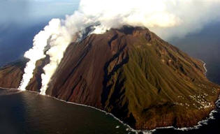 Image: The bronze coast of the island of Stromboli are overcome by the Vancori, we see two lava flows in the Sciara del fuoco.Image: Stromboli: 750 m to the active crater of 300 m in diameter. | | 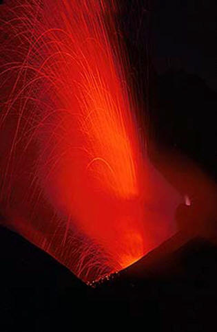 |
Kilauea - Hawaii | | | | |
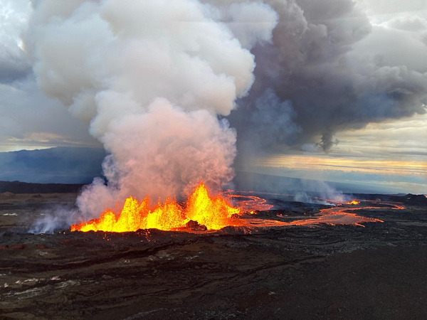
The volcano Kilauea, is the eastern edge of Big Island, the Big Island of Hawaii. It appeared there are 200 000 years on the southern flank of Mauna Loa. The Kilauea volcano is a kind of shield A shield volcano is a type of volcano Effusive. It is usually a large conical volcano at its center with a wide crater filled with washing fluid, called lava lake. A little shield volcano shut down and be replaced by a large hole or an acid lake., (20 000 km3, an area of 1 500 km2. It is the latest emerged volcanoes of Hawaii. It is based on the south-east of imposing its neighbor, Mauna Loa. The Kilauea has its own reservoir magma supply and is a separate entity volcanic Mauna Loa.
The volcanic crater of Kilauea is at an altitude of 1 247 m, i.e. more than 3 000 m below the top of the mountain and forms a large cavity in the side of the mountain. It covers an area of about 10 km2 and its walls are between 60 to 210 m high. In the floor of the caldera is Halemaumau, a large hole 900 m deep and 130 m.
For over 20 years Kilauea spill and now the problem of the Observatory of volcanology is to predict the next eruption, but when it eventually. Since 1983, 104 km2 were covered by lava constituting an estimated 2 km3.
It began on January 3 1983 in the eastern zone of Kilauea when eruptive fissures have opened, freeing real rivers of lava, nappa entire landscape of smooth flows called "pahoehoe". A few months later a building 400 m high, the Puu Oo, emerged lava fields. It houses a lake of lava that for several years, at regular intervals (every 20 to 30 days), was completed by the fountains of lava. These eruptions, amounted to several hundred meters high and the show lasted several hours or days.
In 1986, the cast join the Pacific Ocean. The meeting magma water causes violent explosions and beautiful plumes of steam rising into the sky. | | The lava falling into the water eventually get very specific forms, called "Pillow lavas, which are lava-shaped cushions round. Halemaumau is a pit crater, which is well known in the Parc National des Volcans in Hawaii. The floor of the Kilauea caldera surrounding the Halemaumau. Image: The eruption of Kilauea in 1983 was projected basaltic lava on the slopes of Mauna Loa, volcano near the island of Hawaii. 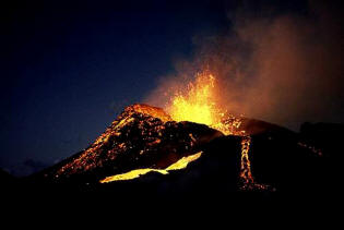 | | 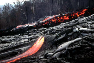
Image: Kilauea, Hawaii: Lava fluid in the foreground and viscous lava flow in the background. |
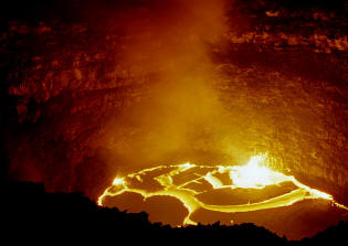
Erta Ale - Ethiopia | | | | |
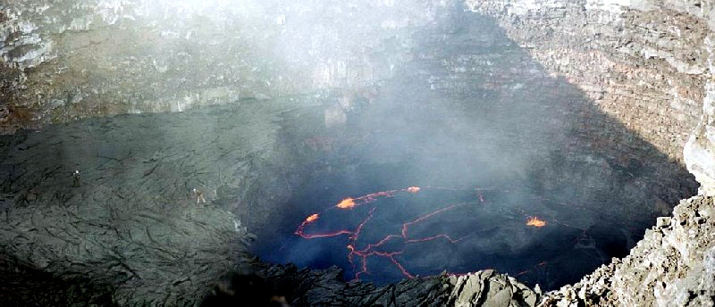
The chain of Erta ale is among the axial channels in Afar, the largest and most characteristic. The Erta Alé is located in the north of the great rift valley in the Danakil Depression. Erta Ale means smoking mountain in Afar. It measures, from north to south, over 95 km long and 42 km wide. It is located along the axis of the northern part of the Danakil Depression, descending to - 120 m below sea level, Ethiopia, near the Red Sea. It includes six buildings volcanic Erta Ale, Gada Ale, Alu-Dala Filla, Boral Ale, Hayli GUB, Alé ring. This desert area with no vegetation is the area of lava. The Afar depression, called Dancalie or Danakil in the north, is an area at the intersection of three boundaries of lithospheric plates, is the meeting place of three rifts, the Ethiopian rift continental rifts and two ocean the Red Sea and Gulf of Aden. The active volcano, Erta Alé is only 613 meters heart of the volcanic chain of Erta Ale. It is a shield volcano, 600 m high slopes very low, supported by a base of 30 km in diameter. His summit with the morphology change depending on volcanic activity, has a caldera collapse (1 600 x 700 m) as that found on the summit of Mauna Loa or Kilauea in Hawaii. Its elliptical caldera is stretched by a north-north-west to south-south-east. Within this caldera crater is called Pit (pit crater), with steep walls, which, depending on the activity, one or more lakes of molten lava. Currently there are two craters pits the crater North and South crater. | | Erta Alé is one of the few active volcanoes in a lake of molten lava permanent, the heat from the washer reservoir is in equilibrium with the heat dissipated into the atmosphere.
Southern crater has a diameter of 140 meters and a depth of 90 m filled by a lake of lava, whose depth varies.
Sometimes, as was the case in February and April 1972, the lake of lava rising pit crater and beyond: lava flows expand then on the floor of the caldera. This active volcano is little known and difficult to access. The first ascent by a European date of 1873. Image: Lake of lava Erta Ale. It is one of three volcanoes in the world, with the Kilauea and Erebus, to contain a permanent lake of lava. | | 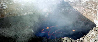
 |
Lengai - Tanzania | | | | |
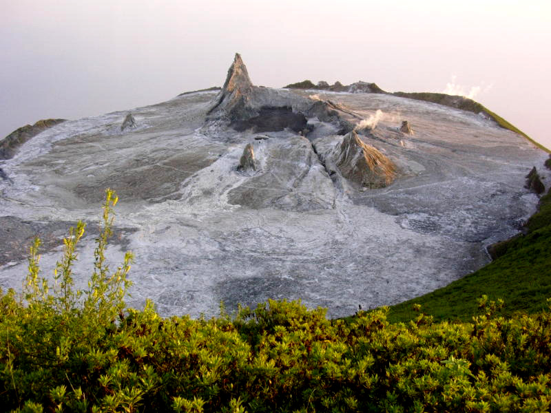
The Ol Doinyo Lengai is a Stratovolcano, i.e. a volcano whose structure is formed from the accumulation of lava, tephra of and / or pyroclastite, conical in shape because of his pasty lava which is hard sells. It is located in Tanzania, in the great rift valley that runs through eastern Africa from North to South. The Ol Doinyo Lengai ( "Mountain of Gods" in Maasai language) is located in northern Tanzania, 70 km from the Kenyan border and 160 km west of Kilimanjaro. This volcano, 370,000 years old, is one of the largest volcanoes in the region and amounts to 2 878 meters, not far from the famous Serengeti Game Reserve. The Lengai, the only active volcano in this area, is also the only volcano on the planet to make carbonatites rich lavas sodium carbonate, iron and calcium, while other volcanoes spew lava globe mainly siliceous. The temperature carbonatites lavas exceptional and unique Lengai vary between 500 and 540 ° C, which is a low temperature compared to temperatures of basalts which are about 1 000 to 1 100 ° C. | | In their emissions, these carbonatites are black like oil drain, then after a few minutes they become chocolate. A day later, these flows cooled deteriorate in contact with the atmosphere and the surface takes a white as snow. Its eruptions are rare, a dozen since the late 19th century. Since the last explosive eruption of 1966, which dug a crater 500 meters by 350 meters to 100 meters deep, the activity has resulted in the continuous outpouring of small lava flows that filled the crater. In 1999, flows have spread beyond the crater to slide down the slopes of Langa. The steep and arduous ascent of the volcano Oldonyo Lengai takes 5 to 7 hours of walking in a remote area in the heart of the Rift Valley in Tanzania. Image: The Lengai spits carbonatites rich lavas sodium carbonate, iron and calcium and low in silica. | |  |
Nyiragongo - Democratic Republic of Congo | | | | |
The Stratovolcano or Niragongo Nyiragongo is one of the most active volcanoes and dangerous Africa.
The Nyiragongo is located in the great Rift Valley, east of the Democratic Republic of Congo near the Rwandan border. The closest cities are the Congolese town of Goma and the Rwandan town of Gisenyi.
The Nyiragongo threatening rises to 3 425 meters and its crater measuring 1.2 kilometers in diameter.
On 17 May 2002, a new lava lake formed in the crater, still active in 2008. It is constantly stirred and kept liquid by the daily rise of gas bubbles of sulfur dioxide.
In 2002 the river of lava had reached the city, cutting into two before joining the Lake Kivu. | | 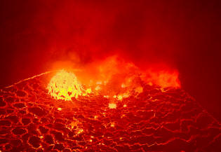 | | 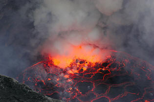 |
Toba - Indonesia | | | | |
Toba is located on the island of Sumatra, on the subduction zone between the Indo-Australian Plate and Eurasian. The super volcano on the island of Toba in Indonesia is the subject of a catastrophic theory on human evolution by Stanley Ambrose, a professor at the University of Illinois at Urbana-Champaign. Volcanoes can cause massive climate disasters, causing a sudden cooling of the mean temperature of Earth.
The super volcano eruption in Indonesia in the island of Toba, there are about 73 000 years, spat an impressive amount of ash estimated at about 2 800 km³, falling to 3 100 km from the volcano.
By comparison, the eruption of Pinatubo in the early 1990s, has issued only 10 cubic kilometers of ash.
The ashes of Pinatubo have changed the albedo of the Earth and have lowered the mean temperature of 0.6°C for two years.
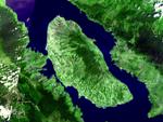
| | In 1998, Stanley Ambrose, said the eruption of Toba caused a global cooling of the planet for 1800 years. Image: Nestled in the heart of the rainforest of Sumatra, the caldera of the island of Toba has impressive dimensions. With its 30 km wide and 100 km long, the caldera is one of the largest in the world. The ancient caldera is filled by a lake in the middle of which lies the island of Samosir, embodying the old dome of the volcano. | |  |
Katla - Island | | | | |
Katla is a gigantic volcano in southern Iceland covered by an ice cap. This is one of the most active volcanoes and most destructive of Iceland, it is the origin of several Outburst particularly brutal and devastating.
The number of small earthquakes near Katla is carefully monitored by volcanologists Iceland because of its dangerousness. The most powerful Outburst take place in Iceland, a volcano covered by an ice cap or ice sheet can drain a lake surface abruptly or blocked by a glacier fjord. As lahars A lahar is a mudflow of volcanic origin. Formed from water, ash and tephras, it occurs most often on the slopes of "gray volcanoes." The lahar from Nevado Del Ruiz engulfed part of the town of Armero in the night from 13 to 14 November 1985, killing in their sleep, nearly 20,000 of the 29,000 inhabitants of the city. It was a nightmare scenario for pyroclastic flows prevailed from the crater glacier melted snow and four enormous lahars streaming down the sides of the mountain at 60 km/h. Lahars descended into beds of the six rivers of the volcano and covered the town of Armero., flows of water or mud density are extremely devastating. This volcano is located underneath the Eyjafjallajökull icecap in a region of mountains, plateaus and glaciers. This huge mountain rises to 1,512 meters, it is crowned by a caldera fourteen kilometers long and ten kilometers wide and 750 meters deep. This gigantic caldera is filled by an ice cap retaining many valley glaciers that descend on the slopes around the volcano Katla. The geography of this particular volcano is worrying for Icelanders and we understand why this volcano is monitored as a mega eruption could melt the polar ice cap and release millions of tons of water and mud everywhere. | | Volcano acquired its present appearance there ≈ 22,000 years ago and 12,000 years, an eruption causes the partial emptying of the magma chamber three kilometers beneath the surface and creates the caldera at the summit of the volcano. Katla is the source of the great volcanic fissure situated in the north-east, about sixty kilometers from the edge of the current icecap.
In 934 an eruption generated a volume of lava among the largest in the world. Since the eruption of Icelandic monitor Katla, twenty were held under the glacier. Subglacial eruptions these were not major consequences for the population. The Icelandic authorities did find that small subglacial eruptions and earthquakes very low in the caldera of the volcano, probably due to rising magma or refill the magma chamber. However, the probability of an eruption increases significantly with time and this reinforces the fears of a major eruption. | |  Image: Katla is part of the eastern volcanic zone of Iceland which includes other volcanoes like Hekla, Laki and the Vatnafjöll. Fluid lavas of this type of volcano are not explosive, but on Katla, the lava to cross the ice cap that increases the explosiveness of lava and causes Outburst. |


 Mauna Loa is the largest volcano in the world!
 Kamchatka, exceptional land of fire
 The threat of supervolcanoes
 The active volcanoes of Colombia
 New Zealand volcanoes
 Volcanoes at the origin of life
 The great ocean trenches
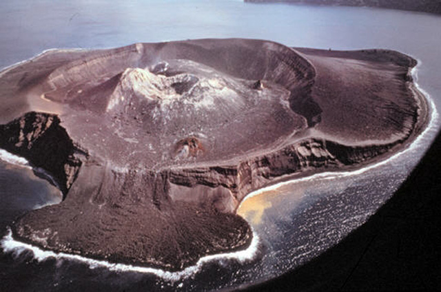
 Birth of an island, rising from the waters
 Chimborazo in Ecuador, the highest mountain in the world
 Super eruption disaster
 The great calderas of the planet
 Africa's Active Volcanoes
 Supervolcanoes have changed life on Earth
 The Nevado del Ruiz volcano
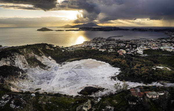 The Phlegraean Fields
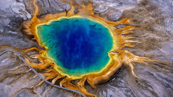 The Yellowstone Supervolcano
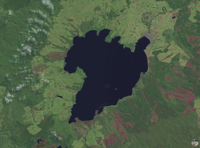 The spectacular caldera of Lake Taupo